Use this map to view the various legislative districts in Kendall County.
Left Side Panel: Layer List
On the left-hand side, users can find a list of the different layers in the map. Clicking the eye icon will toggle each layer on and off.

Next to the layer list is a legend, showing what the various symbols in the map refer to.
The Map
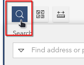
In the center of the screen is the map. This shows all active layers. You can search for specific parcels or addresses using the map’s search tool, or just navigate the map as you do elsewhere.
Parcel-Specific Information
Click a parcel to view information about the precinct, polling place, and any legislative districts to which the parcel is assigned, as well as a few other key details about the property.
Right Panel
At the right side of the screen are several lists of the different legislative districts in the county, separated by type. Clicking any of these will display it prominently on the map, as well as move the map to the feature’s location.
If the map is zoomed in too far to see the district, simply click the Home button to return to the full county extent.
![]() Note: legislative district features have been clipped to the boundary of the county.
Note: legislative district features have been clipped to the boundary of the county.